

 25℃
25℃
| Windstärke | 4.1 m/s NW |
| Bewölkung | 0 % |
| Luftdruck | 1013 hpa |
| Luftfeuchtigkeit | 65 % |
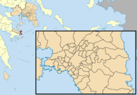
Poros is a small Greek island-pair in the southern part of the Saronic Gulf, at a distance about 58 km (31 nautical miles) south from Piraeus and separated from the Peloponnese by a 200-metre wide sea channel, with the town of Galatas on the mainland across the strait. Its surface is about 31 square kilometres (12 sq mi) and it has 4,117 inhabitants. The town of Poros has 4,102 of these inhabitants. The only other inhabited settlement is Ágios Nektários (pop. 15). The ancient name of Poros was Pogon. Like other ports in the Saronic, it is a popular weekend destination for Athenian travellers. Poros consists of two islands: Sphairia, the southern part, which is of volcanic origin, where today's city is located, and Kalaureia, also Kalavria or Calauria (meaning 'gentle breeze'), the northern and largest part. A bridge connects the two islands over a narrow isthmus. The Municipality of Poros also includes a part of the mainland, Kyaní Aktí (pop. 231), at the easternmost point of the Peloponnese Peninsula, between the island of Poros and the island of Hydra and next to the municipalities of Troizina and Ermioni. The total land area of the municipality is 49.582 km², and the total population is 4,348 persons. Poros is an island with rich vegetation. Much of the northern and far eastern/western sides of the island are bushy, whereas large areas of old pine forest are found in the south and center of the island. It has a good road network and adequate tourist infrastructure, which makes it a popular resort for short holidays. Though possessing no airport, it is easily accessible from Athens via ferry or hydrofoil or from the adjacent mainland at Galatas.
Quelle: wikipedia.org